|
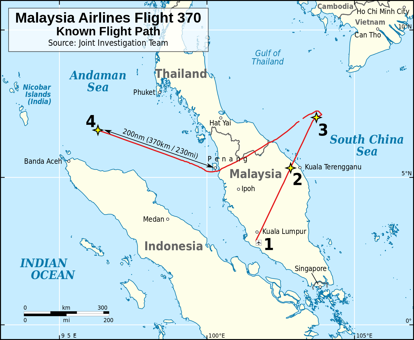
THE MALAYSIA AIRLINES MYSTERY March 8, 2014 – 12:41 a.m. – Malaysia Airlines Flight MH-370, a 777 Boeing twin engine passenger jet departs Kuala Lumpur Airport on a scheduled flight to Beijing with 239 passengers – 1:19 AM. the cockpit responds to Malaysian air traffic control with, “Good night Malaysian three seven zero,” as the plane prepares to leave Malaysian airspace and enter Vietnamese airspace over the South China Sea. ~
1:21 a.m – The aircraft’s transponder signal disappears from civilian radar screens. Malaysian military radar shows the aircraft deviating from the scheduled flight path shortly after signing off with Malaysian flight control. It turns westward, crosses back over the Malay Peninsula, and heads northwest over the Strait of Malacca and at 2:22 a.m. military radar lost contact northwest of Penang Island.
The geoglyph is 600 feet tall, large enough to be seen 12 miles at sea. The central element of the Geoglyph suggests a runway with a plane taking off, on a bearing parallel to the great circle intersecting Kuala Lumpur and Beijing with the side elements suggesting Angkor Wat, Machu Picchu and their antipodal points. All the statues on Easter Island faced the centre of the island, except 7 statues facing west, toward Angkor Wat.
A great circle intersecting the pyramids, at the Giza Plateau, and Easter Island intersects a great circle intersecting Kuala Lumpur and Beijing, midway between Machu Picchu, Angkor Wat and their antipodal points. The pyramids are 72 longitude degrees west of Angkor Wat. Angkor Wat faces West and temple reliefs were designed to be viewed anticlockwise, a common practice in Hindu funerary rites and a great circle intersecting Machu Picchu and Angkor Wat intersects the Equator at the Prime Meridian.
THE TIMELINE 3,172 BC – Mayan Long Count begins. March 8, 2014 – MH-370 disappears. March 8, 2024 -10th anniversary, MH-370 disappearance. Nov. 18, 2024 – New Jersey drone sightings began. Oct. 30, 2025 – 3i/Atlas in perihelion behind the sun March 8, 2034 -20th anniversary, MH-370 disappearance.
|
Atoms are Electrons and Positrons
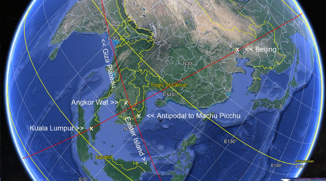 The flight path from Kuala Lumpur to Beijing passes midway between Angkor Wat, Cambodia, and the antipodal point to Machu Picchu, Peru and describes a great circle, if continued, which passes midway between Machu Picchu and the antipodal point to Angkor Wat, at the Paracas Geoglyph at Pisco Bay, Peru.